Building date: c. 1851, gone 1996
Original use: Smokehouse
Corner structures:
Mortar application and content:
Types and uses of stones:
Types and choice of windows:
Structures with similar masonry details:
Masons who worked on building:
Unique features:
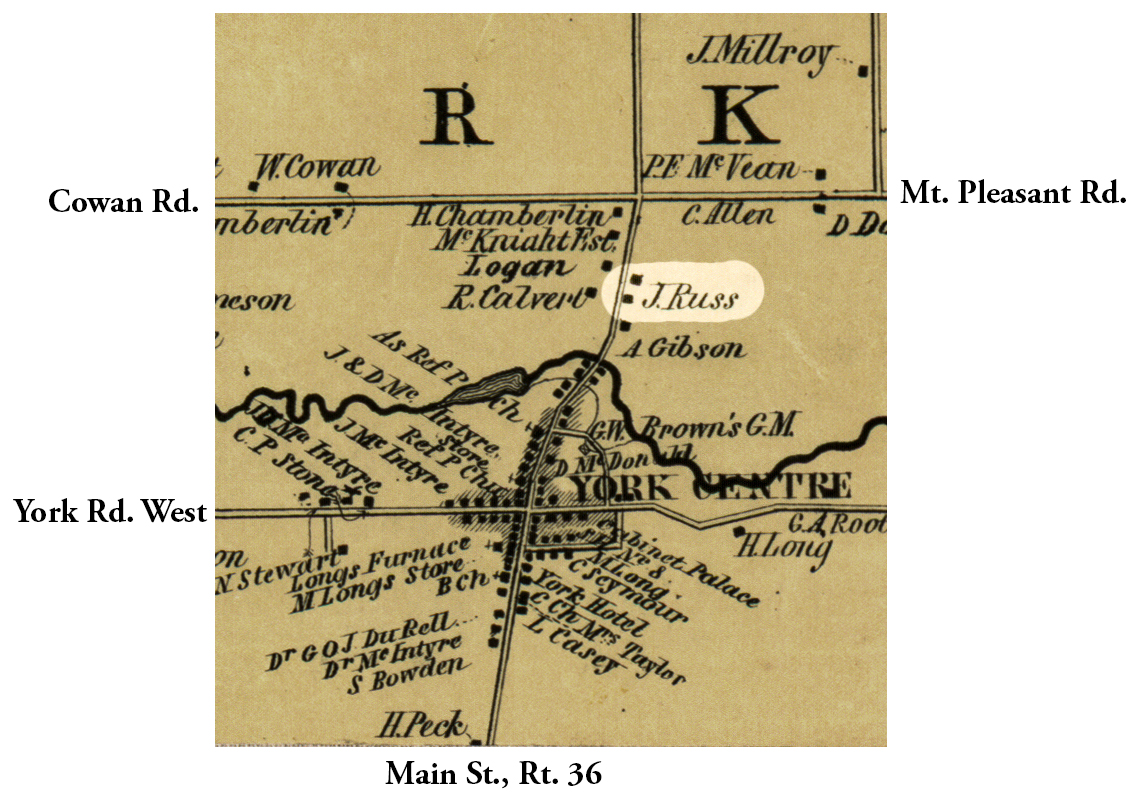
Map views approximate location courtesy Google Maps. Address and location can not be confirmed. Approximate location 42°52'37.69"N 77°52'54.21"W.
Town of York and Livingston County Maps.
On a survey sheet (link below), Mr. Donnan¹ links John Russ to Alex. Reid and Hugh Carson, suggesting that our brick-cornered smokehouse was the one just north of York Village on Rt. 36. Looking at the 1852 map it might be around 2563 Main St/Rt.36, though this is an approximation. Per an additional note by Pat Schaap² on another page, "Gone 1996." Holly Watson, Deputy Livingston County Historian, email 11/30/2020.
¹ Arthur Donnan, former York Town Historian.
² Pat Schaap, former Livingston County Historian.
Permanent File of Cobblestone Structure
 1852 Livingston County Map Excerpt.jpg ¹ | 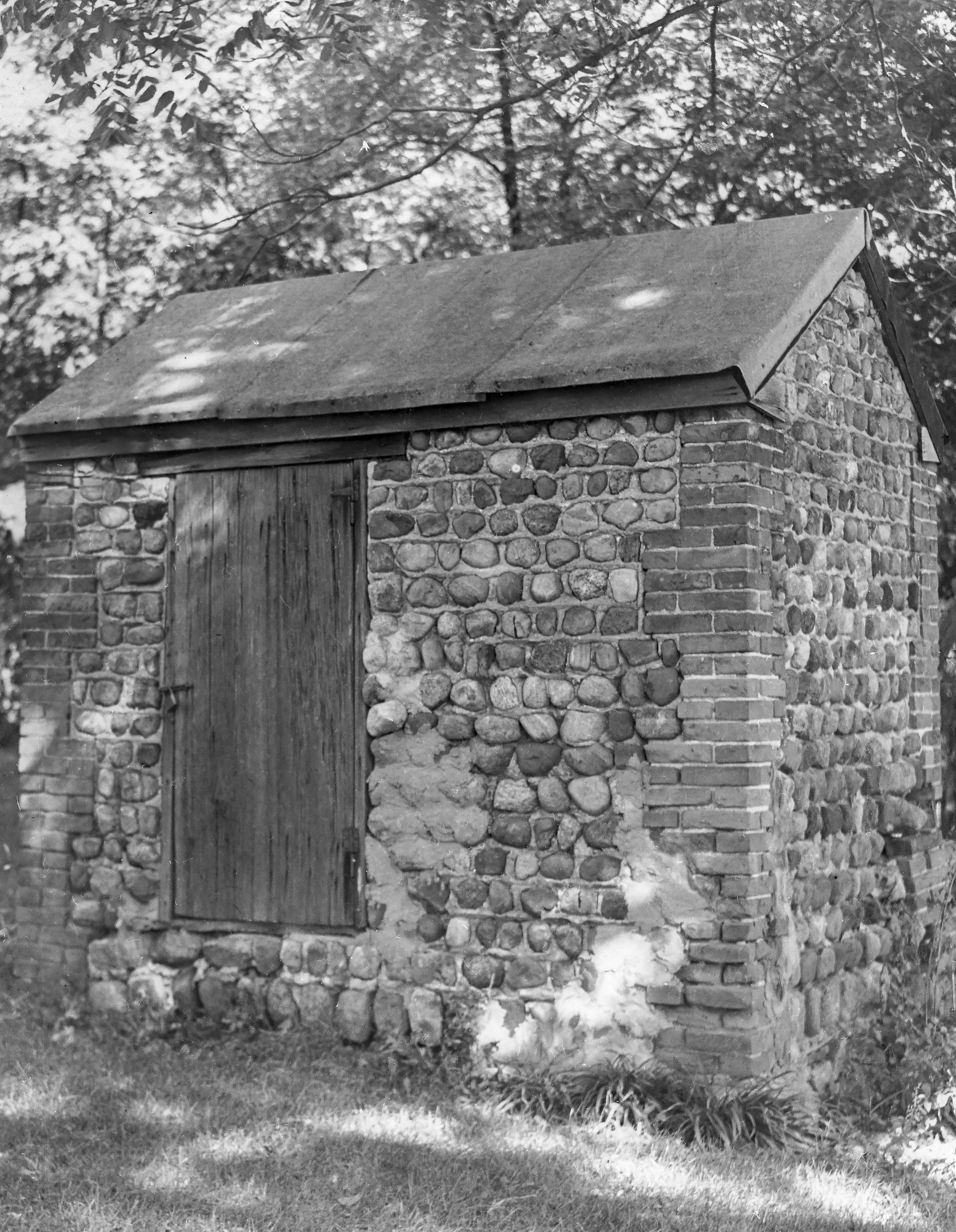 Yor-5 Smokehouse 1.jpg ² 1947 |  B15 F13 p5773.jpg ³ | 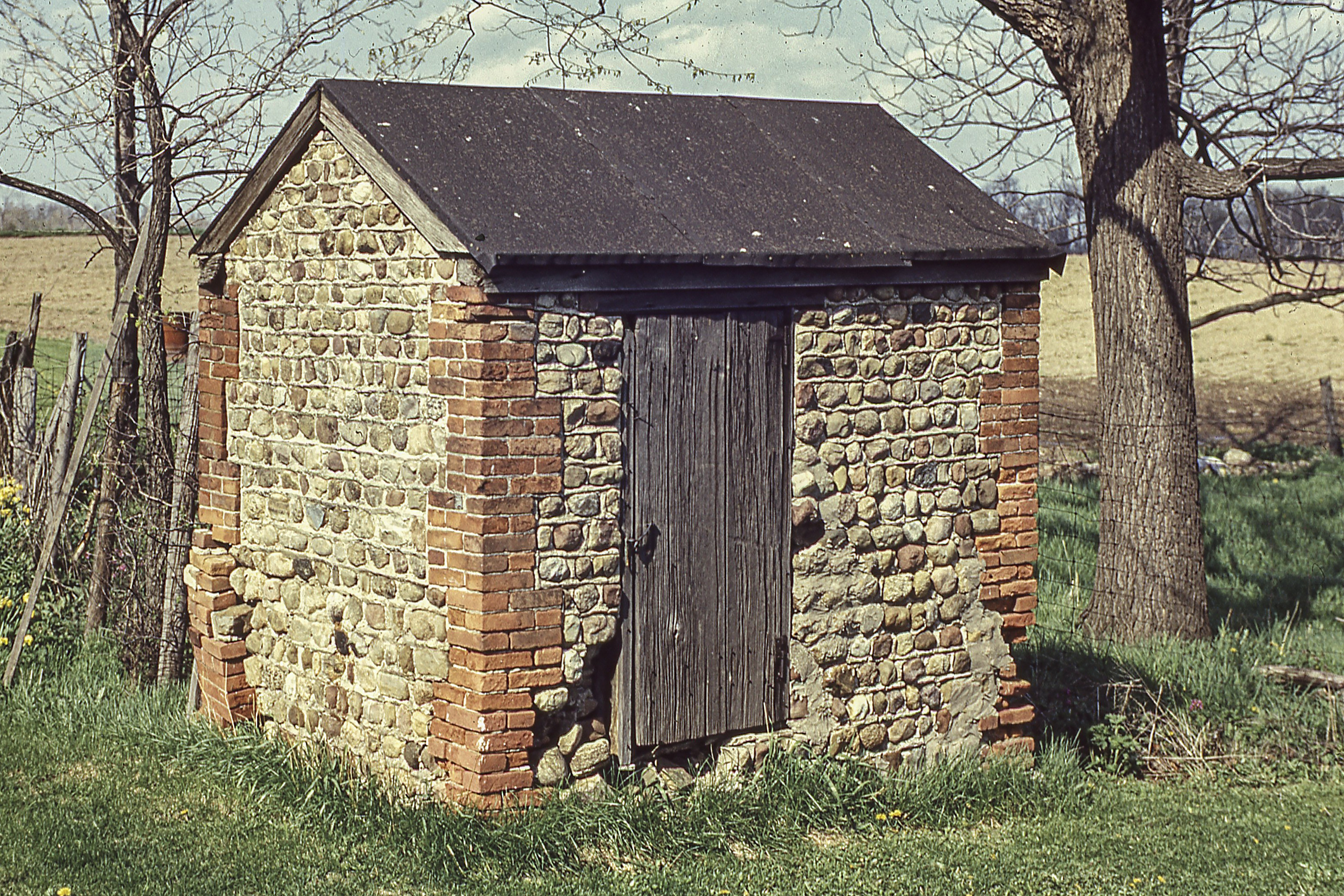 B1-B5 119.jpg ³ |
¹ 1852 Livingston County Map excerpt courtesy Library of Congress.
² Photography courtesy John Vrooman, from the archives of the Cobblestone Museum. The photo might have been taken in 1947 for a NYS Department of Education project that documented historic structures and sites as selected by local historians. Holly Watson, Deputy Livingston County Historian, email 11/30/2020.
³ Images courtesy Holly Watson, Deputy Livingston County Historian
